

OPCIONES DE ENTREGA LOCAL
La entrega estándar suele tardar entre 3 y 7 días.La entrega urgente suele tardar entre 2 y 4 días.
GARANTÍA DE PRECIO
Si encuentras un precio más barato en las próximas 72 horas lo igualaremos.


Original price was: 749,99 €.619,83 €Current price is: 619,83 €.
You save
Agotado
La entrega estándar suele tardar entre 3 y 7 días.La entrega urgente suele tardar entre 2 y 4 días.
Si encuentras un precio más barato en las próximas 72 horas lo igualaremos.
Consigue un descuento inicial del 5% en tu primer pedido registrándote en la comunidad SailRACE.
Obtenga asistencia de expertos con certificación oficial. Detállenos sus necesidades de reacondicionamiento y le ayudaremos a determinar la mejor solución.
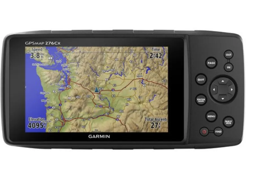
The legend is back
If you want to enjoy Garmin navigation in all its splendor, the GPSMAP 276Cx is the ideal device. With this navigator, you will be able to move with maximum precision off the roads or on the water wherever you are. The new 276Cx adds a complete series of high-end navigation functions that at no time limit the experience of the original 276. With a huge 5″ screen, advanced sensors such as GPS+GLONASS, barometric altimeter and three-axis compass, complete nautical and off-road functions, and excellent compatibility with maps, the new GPSMAP 276Cx is the best possible successor for this legendary range of products.
The true experience 276
The new GPSMAP 276Cx has been developed from the legendary GPSMAP 276C, which became famous for being the most versatile and powerful off-road navigator ever manufactured by Garmin. To ensure that the experience remains faithful to the 276, Garmin has kept much of the user interface unchanged; even the keyboard is exactly the same as its predecessor. Lovers of the 276 will appreciate the enormous customization capacity of their new browser, and will be amazed by all the new features that have been added to the classic 276.
Advanced sensor technology
The sensor technology of the GPSMAP 276Cx has been thoroughly renewed. It now has GPS and GLONASS positioning functions that improve performance in the most challenging environments. And, if you want to enjoy optimal satellite tracking inside the vehicle, add an external antenna (not included) to the integrated MCX connector. To improve the knowledge of the situation, it also incorporates a barometric altimeter that allows you to obtain elevation readings and a 3-axis electronic compass that will allow you to orient yourself correctly in any situation, even when you are standing.
User interface optimized for the outdoors
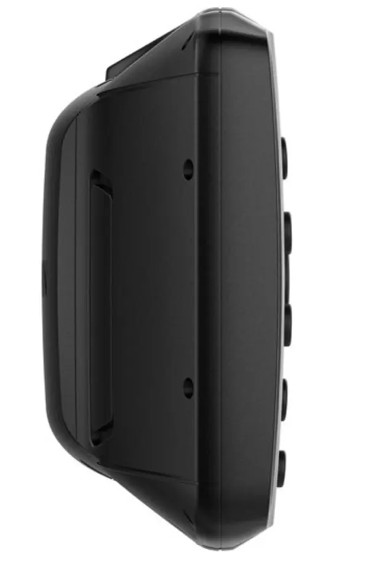
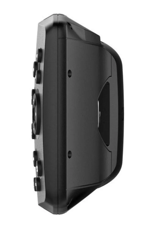
We know that being able to read the screen well during navigation is extremely important, and that is why the new GPSMAP 276Cx is equipped with a huge 5″ screen, which can be read without problems outdoors and with a rich color palette that improves the visualization of maps. In addition, its fantastic viewing angle allows you to see its content with total clarity in different positions. In this way, even if the navigator is installed in the cabin or the dashboard, its fantastic clarity and its button interface allow you to operate it safely even in unstable environments, such as a boat or an off-road vehicle.
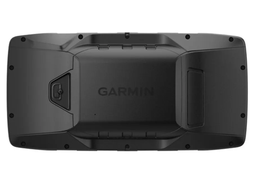
Resistant and durable
Thanks to a construction that perfectly meets the demanding standards of Garmin, this device responds in virtually any situation. Its robust mounting system has been thoroughly tested, which gives the device exceptional resistance and a water resistance rating of up to IPX71. After more than 4 years of experience with the Montana®, we can offer solid supports that can be installed on virtually any vehicle or boat. For you to enjoy even more freedom, the power supply of the device is now more flexible: you can connect it to the power supply of the vehicle or boat, or use the NiMH battery (which provides up to 17 hours of autonomy) or 3 AA batteries (up to 9 hours of autonomy).
More maps and more memory
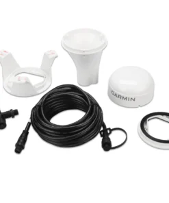
The GPSMAP 276Cx has compatible maps to take you to practically anywhere you want to go. It includes a large internal memory of 8 GB with a world base map and a map of pre-installed European leisure routes. It is also compatible with numerous optional maps, such as BlueChart® g3 maritime charts, Garmin TOPO and TOPO PRO map maps, City Navigator® NT and Garmin custom maps. Likewise, a microSD™ slot allows you to expand the memory to be able to load additional maps.
More navigation
In combination with the right maps, the GPSMAP 276Cx allows you to enjoy additional navigation functions, such as the well-known automotive mode for street navigation or routes on curved roads for motorcyclists that will allow you to discover less traveled and more interesting roads to travel on a motorcycle. In combination with the TOPO PRO maps, the device can choose from several leisure route options to find the most suitable road types for each activity or vehicle. And, for those who prefer navigation with tracks and tracks, the new 276Cx also has an advanced track navigation function.
Advanced connection functions
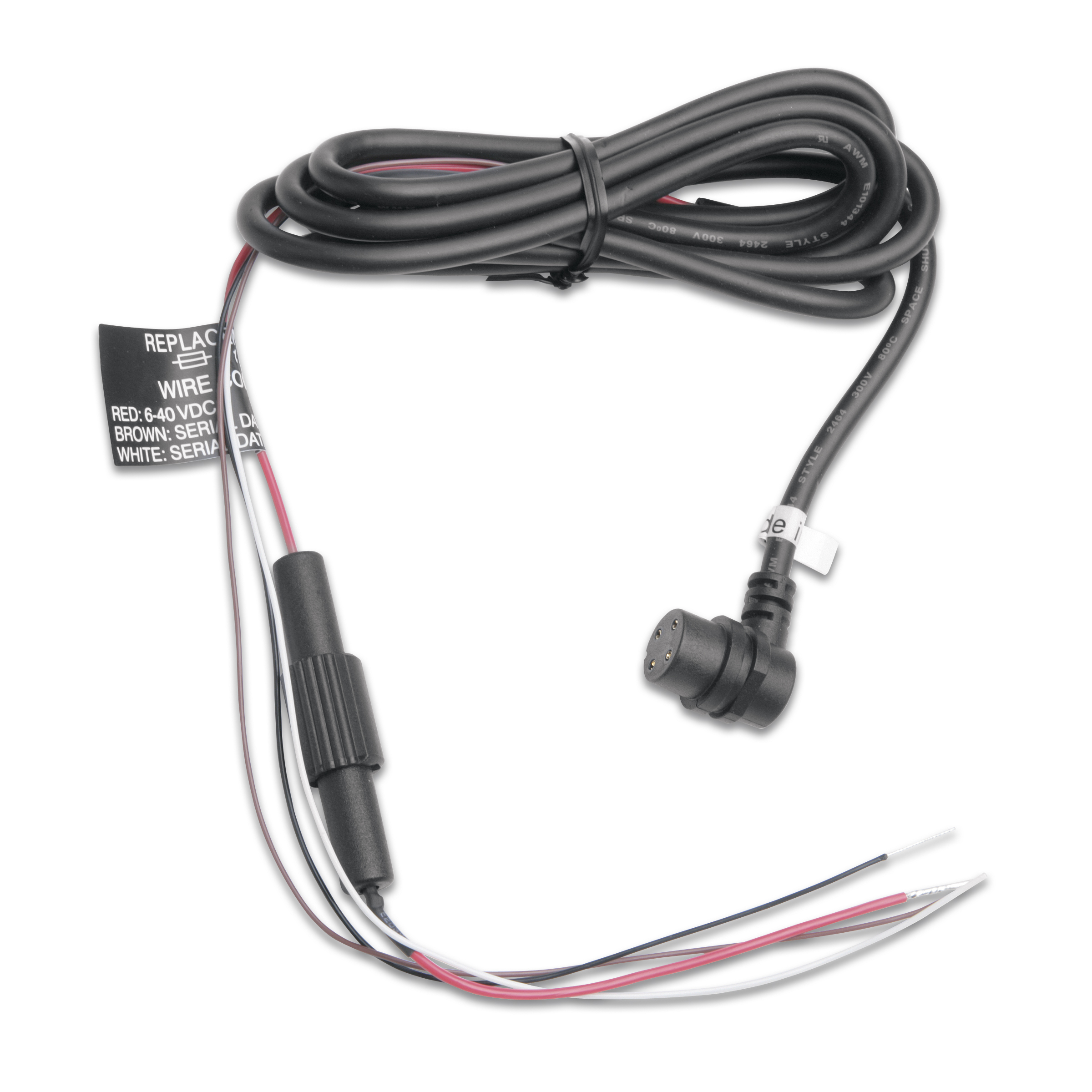
The new GPSMAP 276Cx also has several advanced connection functions. The 276Cx can be connected to Bluetooth headphones to receive TTS indications directly on the helmet. Or, if you connect it to a smartphone2, you can receive Active Weather data3, such as weather predictions and the visualization of an animated weather radar on the map screen, receive intelligent notifications such as email messages, SMS or social media notifications, or use LiveTrack, which allows you to share your exact location with your family and friends. The device can also be connected wirelessly through ANT+ to external sensors such as tempe™, which records the outside temperature, or it can be connected to a Wi-Fi network to receive updates and synchronize your data with the Garmin Connect™ database.
| Características físicas y de rendimiento | |
|---|---|
| DIMENSIONES DE LA UNIDAD (ANCHURA/ALTURA/PROFUNDIDAD) | 191,5 x 94,5 x 44,0 mm |
| PESO | 450 g with rechargeable battery included; 415 g with AA batteries (not included) |
| CLASIFICACIÓN DE RESISTENCIA AL AGUA | IPX7 |
| TIPO DE PANTALLA | Bright WVGA screen that can be read in sunlight |
| TAMAÑO DE LA PANTALLA (ANCHO/ALTO) | 127.0 mm (5.0″) diagonal |
| RESOLUCIÓN DE PANTALLA (ANCHO/ALTO) | 800 x 480 Pixels |
| BATTERY | Rechargeable lithium-ion battery (included) or 3 AA batteries (not included); NiMH or lithium is recommended |
| BATERÍA/AUTONOMÍA DE LA BATERÍA | Up to 16 hours (lithium-ion); up to 8 hours (AA batteries) |
| MEMORY/HISTORICAL | 3.2 GB (6 GB can be used) |
| INTERFACE | high speed mini USB and NMEA 0183 compatible |
| Mapas y memoria | |
|---|---|
| PRE-INSTALLED MAPS | Pre-installed map of leisure routes in Europe |
| POSSIBILITY OF ADDING MAPS | Sí |
| BASE MAP | Sí |
| AUTOMATIC CREATION OF ROUTES (TURN TO TURN ON THE ROAD) | Yes (with optional maps with detailed information on the roads) |
| AUTOMATIC CREATION OF ROUTES (TURN TO TURN ON THE ROAD) FOR MOTOR VEHICLES | Sí |
| SEGMENTS OF THE MAP | 15,000 |
| BIRDSEYE | No |
| IT INCLUDES HYDROGRAPHIC ACCIDENTS WITH A HIGH LEVEL OF DETAIL (COASTAL LINES, COASTLINES OF LAKES AND RIVERS, SWAMPS AND PERENNIAL AND SEASONAL STREAMS) | Yes (pre-installed City Navigator version) |
| INCLUDES SEARCHES FOR POINTS OF INTEREST (PARKS, CAMPING AREAS, PICTURESQUE WATCHTOWS AND PICNIC AREAS) | Yes (pre-installed City Navigator version) |
| SHOW NATIONAL, REGIONAL AND LOCAL PARKS, FORESTS AND NATURAL LANDSCAPES | Yes (pre-installed City Navigator version) |
| STORAGE AND LOADING CAPACITY | microSD™ card (not included) |
| WAYPOINTS | 10.000 |
| PISTAS | 250 |
| PISTAS | 20,000 points, 250 tracks saved |
| RUTAS | 250, 250 points per route; 50 points auto routing |
| Sensores | |
|---|---|
| GPS | Sí |
| GLONASS | Sí |
| BAROMETRIC ALTIMETER | Sí |
| COMPASS | Yes (three axes with compensated inclination) |
| HIGH SENSITIVITY RECEIVER | Sí |
| GPS COMPASS (ON THE MOVE) | Sí |
| Daily Smart Functions | |
|---|---|
| SMART NOTIFICATIONS ON THE HANDHELD DEVICE | Sí |
| SMART TIME FORECAST | Sí |
| ACTIVE TIME | Sí |
| REMOTE CONTROL FOR VIRB® | Sí |
| COMPATIBLE WITH GARMIN CONNECT™ MOBILE | Sí |
| Outdoor Leisure Functions | |
|---|---|
| POINT-TO-POINT NAVIGATION | Sí |
| CALCULATION OF AREAS | Sí |
| FISHING FORECAST | Sí |
| ASTRONOMICAL INFORMATION | Sí |
| GEOCACHING MODE | Sí |
| COMPATIBLE WITH CUSTOM MAPS | Yes (500 custom map tiles) |
| IMAGE VIEWER | Sí |
| CAMERA | No |
| Conexiones | |
|---|---|
| CONECTIVIDAD INALÁMBRICA | Yes (Wi-Fi®, BLUETOOTH®, ANT+®) |
| Más información en | |
|---|---|
| CARACTERÍSTICAS ADICIONALES |
|
| Marca |
|---|
Los siguientes productos son de la misma categoría que éste:


Garmin

Agotado


Reseñas
Aún no hay comentarios